Three years ago, Sr Marie Reine Fournier was the editorial assistant for our Jesus Dictionary. She has now been collaborating with the Jerusalem office for almost a year.
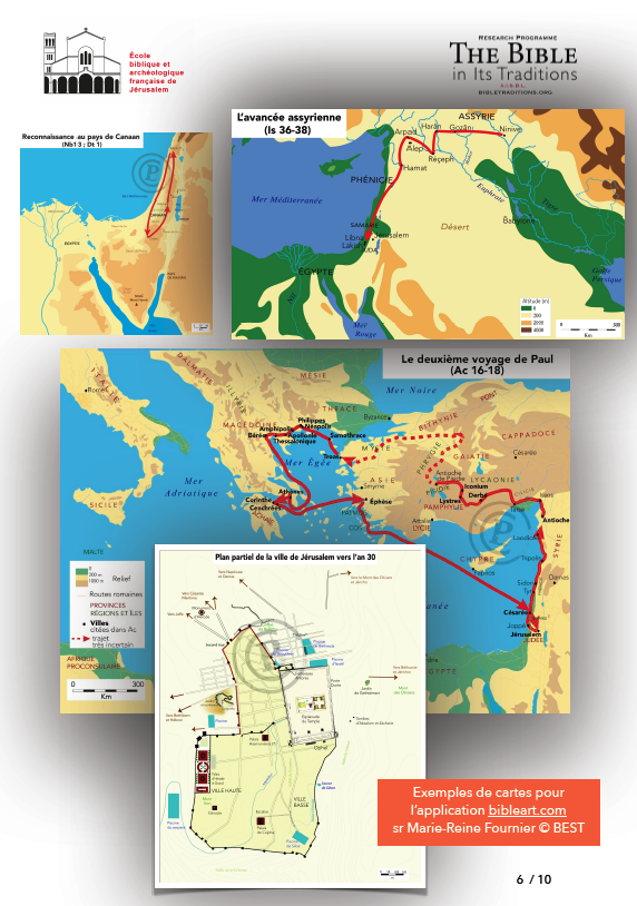
After (self-)training in Adobe Illustrator software, she has created more than a hundred geographical maps in recent months to help readers of the Bible in its traditions to locate biblical cities, to understand battle plans, to visualise roads, etc…
Entirely digital, these maps illustrate the biblical text, taking into consideration the most recent archaeological and topographical research (such as the theses of D.M. Cabaret o.p. or J.R. Reyes o.p.) and the advice and corrections of several professors of the École Biblique (O.-T. Venard o.p., J. Vargas o.p., Ł. Popko o.p., O. Catel o.p., B. Mahieu, Y. Demirci, o.f.m. Cap).
Sr Marie-Reine is currently working on inserting them into our media library, and then making them available along with the biblical text.


